(Credit: leolintang/Shutterstock)
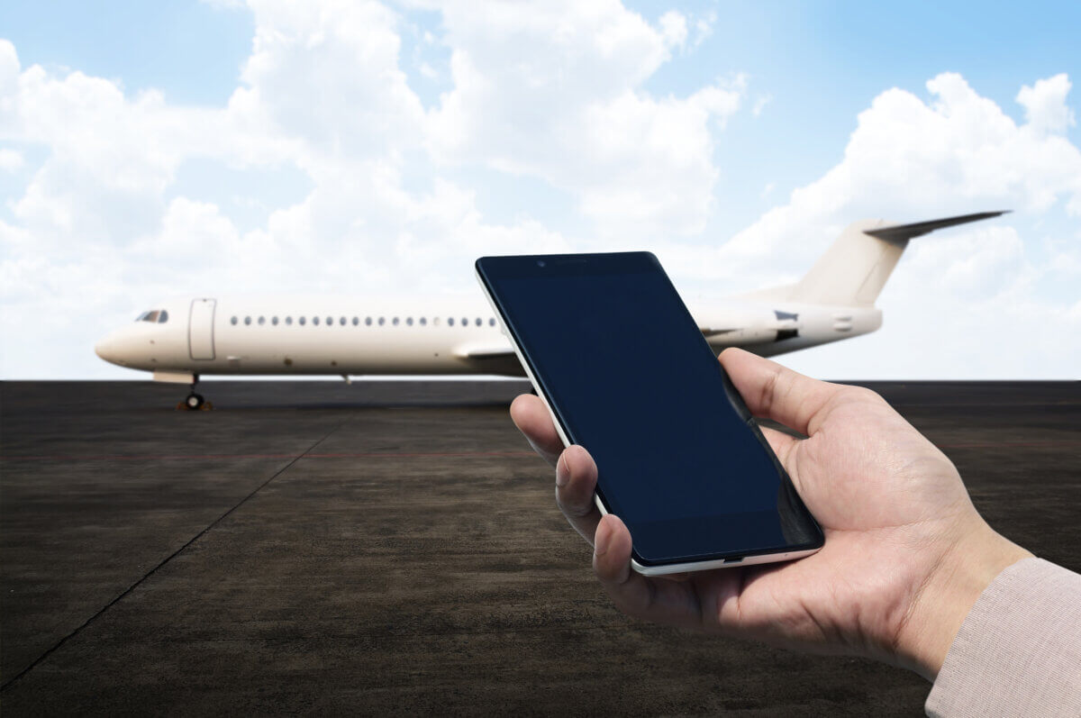
ALBUQUERQUE, N.M. — In an era where GPS guides everything from weekend road trips to commercial airline routes, a team of researchers is preparing for a worrying scenario: What happens when GPS fails? Their solution involves a creative combination of weather balloons, Styrofoam coolers, and radio waves from unexpected sources: cellphone towers.
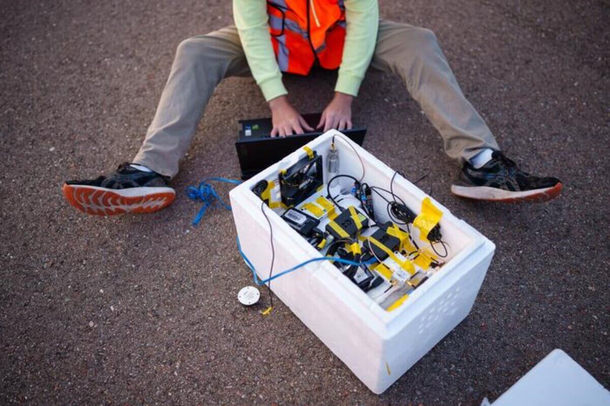
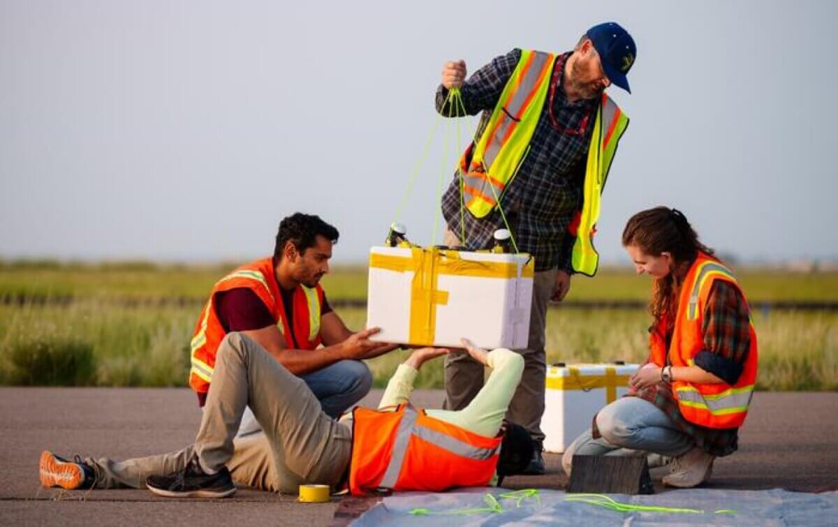
Picture this: A typical Styrofoam cooler dangling from a weather balloon, floating in the thin air where the blue of our atmosphere meets the blackness of space. While it might look like a science fair project, this unassuming container could hold the key to making air travel safer when GPS systems malfunction.
Presenting their work at the Institute of Navigation GNSS+ conference, researchers from Sandia National Laboratories and The Ohio State University are developing an innovative backup navigation system for aircraft by harnessing something we rarely think about: the invisible web of radio signals that constantly surrounds us. Their experimental technology could serve as a safety net when GPS — the system we’ve come to rely on for everything from landing planes to finding the nearest coffee shop — becomes unreliable.
“We’re not trying to replace GPS,” explains Jennifer Sanderson, the lead researcher at Sandia, in a media release. “We’re just trying to assist it in situations where it’s degraded or compromised,” situations that can put pilots and passengers at risk.

The need for a backup system is more pressing than you might think. While GPS has become the gold standard for navigation, it’s not invulnerable. Pilots flying near conflict zones increasingly find their GPS systems disrupted or unreliable. Even closer to home, illegal “jammers” — devices that flood GPS frequencies with meaningless signals — can be purchased online despite being against the law.
Perhaps more worrying is a technique called “spoofing,” where fake GPS signals trick receivers into showing incorrect locations. If this sounds far-fetched, consider this: the same technology is already being used by players trying to cheat at Pokémon Go.
“There are actual apps you can download that allow you to spoof your location, and entire subreddits dedicated to showing you how to use it for various games,” Sanderson notes.
While harmless in a mobile game, this technology could have serious consequences if used against aircraft.
Looking to the Skies for Solutions
The research team’s approach is ingenious in its simplicity: instead of relying solely on GPS satellites, why not use the countless other radio signals already floating through our skies? Cellphone towers and non-GPS communications satellites constantly emit radio frequency waves that could serve as navigation beacons.
To test this idea, the team sent their experimental equipment skyward via weather balloon, reaching heights of up to 80,000 feet — about 15 miles up. That’s roughly three times higher than commercial aircraft typically fly and far higher than previous studies that only reached 5,000 to 7,000 feet.
Their equipment, housed in that ordinary-looking Styrofoam cooler, included specialized antennas designed to detect and measure various radio signals. By analyzing how these radio waves become compressed or stretched as they travel (known as the Doppler effect — the same phenomenon that makes a passing ambulance siren change pitch), the researchers can potentially calculate an aircraft’s position and speed. The early results have been promising.
“While we are still processing the flight data, we believe our preliminary findings indicate that we detected cell tower signal beacons at our peak altitude of about 82,000 feet,” Sanderson says. “If these signals are clean enough for navigation, it will significantly change what we thought was possible for alternative navigation.”
The Road Ahead
The research is still in its early stages. Currently, the team must manually match received signals to their sources using reference data — a tedious process that will need to be automated before the system can be used in real-world situations.
“The not-sexy but very important side of navigation is understanding all your error sources,” Sanderson explains.
However, the potential impact of this work extends far beyond aviation. Our modern society has become deeply dependent on GPS for everything from farming to financial markets. Having a reliable backup system could help prevent widespread disruption if GPS services were to fail.
While your next flight probably won’t be navigating by cell phone towers just yet, this innovative research shows that solutions to complex problems might be hiding in plain sight — or in this case, floating in the signals all around us.


