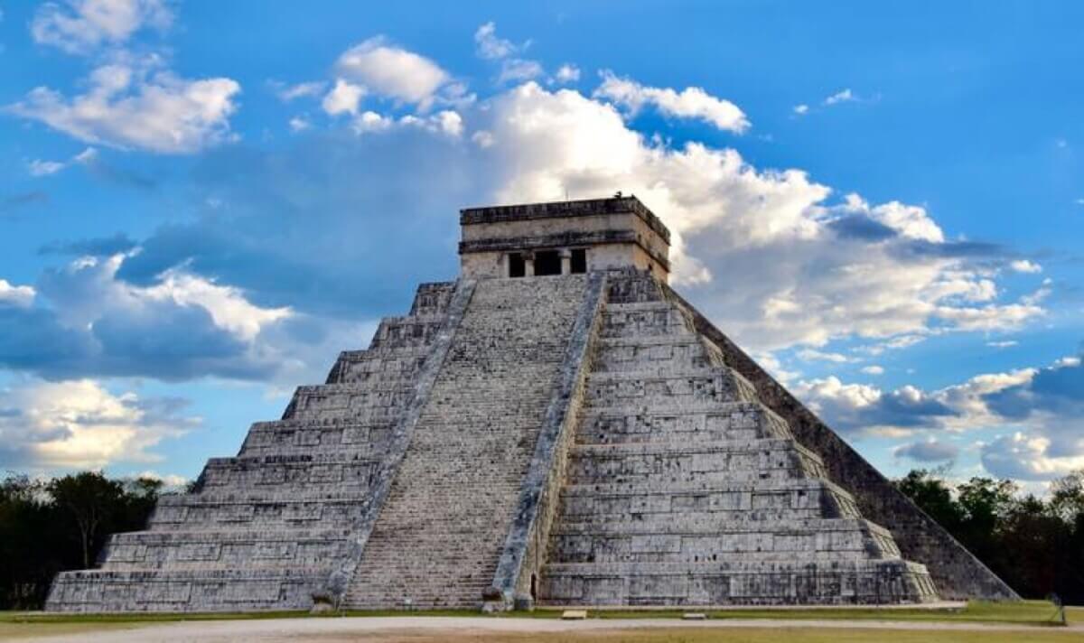
El Castillo, also known as the Mayan Temple of Kukulcan, is among the largest structures at Chichén Itzá. (CREDIT: Johannes Krause)
NEW ORLEANS — Hidden beneath the forests of Mexico’s Campeche state lies an archaeological revelation: where scientists once saw empty jungle, they now find evidence of extensive ancient Maya settlement. Using advanced laser scanning technology, archaeologists have documented over 6,500 previously unknown structures across just 50 square miles of the jungle – including an entire lost city that had remained hidden in plain sight for centuries.
The research, published in the journal Antiquity, provides definitive evidence that the Maya lowlands supported far larger populations than previously believed, with settlement patterns ranging from crowded urban centers to rural farmsteads. Most significantly, the study suggests that dense settlement was not exceptional but rather the norm across much of the Maya world.
Led by Luke Auld-Thomas, a doctoral student at Tulane University, and Professor Marcello A. Canuto, the research team made their discoveries by analyzing laser-scanning (LiDAR) data that was originally collected for an environmental study. This technological approach allowed them to peer through the dense jungle canopy to reveal ancient structures and landscape modifications that are invisible from both the ground and traditional aerial photography.
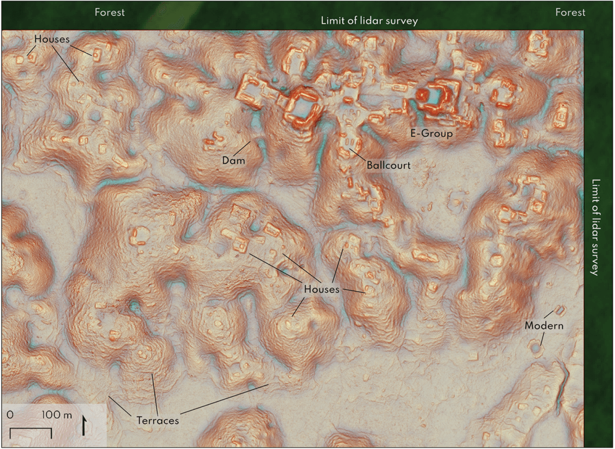
Among their most striking discoveries was a previously unknown major city, which the researchers named Valeriana, located near a modern highway where local farmers had been working among the ruins for years without realizing their significance. The city features all the hallmarks of a Maya political capital: pyramids, plazas connected by broad causeways, a ballcourt, and sophisticated water management systems.
“Our analysis not only revealed a picture of a region that was dense with settlements, but it also revealed a lot of variability,” Auld-Thomas explains in a statement.
What makes this study particularly significant is that the surveyed areas were chosen randomly – not based on known archaeological sites – providing an unbiased sample of what Maya landscapes typically looked like.
The findings help resolve a long-standing debate about Maya population density. Some archaeologists had suggested that previous surveys, focused on known major sites like Tikal, might have created a distorted picture of Maya settlement patterns. However, this new research demonstrates that even randomly selected areas contain evidence of extensive urban development.
The research team conducted their analysis at Tulane University’s Middle American Research Institute (MARI), which has been at the forefront of using LiDAR technology in archaeological research over the past decade. Using MARI’s state-of-the-art Geographic Information Systems (GIS) lab, researchers analyzed data covering three long strips of land and three larger rectangular blocks in Mexico’s Campeche state.
LiDAR works by shooting millions of laser pulses from an aircraft down to the ground. These pulses penetrate through the forest canopy and bounce back, creating a detailed 3D map of the ground surface. This allows archaeologists to identify ancient structures and landscape modifications that would be nearly impossible to spot from the ground or through traditional aerial photography.
Within their survey area, researchers found dramatic variations in how the ancient Maya modified their environment. In the southern regions, they discovered extensive agricultural terracing and field walls, demonstrating sophisticated farming practices. However, these features became less common in northern areas, where different architectural styles emerged – helping archaeologists better understand the boundaries between different Maya cultural regions.
The density of structures varied significantly across the survey area. Some rural zones contained relatively few buildings, while urban centers packed in more than 400 structures per square kilometer – comparable to modern suburban densities. This variation is exactly what you’d expect to see in a complex urban society, with busy city centers gradually transitioning to less crowded suburban and rural areas.
“Lidar is teaching us that, like many other ancient civilizations, the lowland Maya built a diverse tapestry of towns and communities over their tropical landscape,” notes Professor Canuto, director of MARI. “While some areas are replete with vast agricultural patches and dense populations, others have only small communities. Nonetheless, we can now see how much the ancient Maya changed their environment to support a long-lived complex society.”
The study’s findings contribute to a growing recognition that tropical regions, far from being pristine wildernesses in the past, were home to sophisticated urban societies. Similar patterns of extensive landscape modification have been found at other tropical sites worldwide, including Cambodia’s Angkor Wat and recently discovered settlements in the Amazon.
This research demonstrates that the Maya did more than build isolated cities – they created entire urbanized landscapes that supported large populations through complex engineering and agricultural practices. By analyzing LiDAR data originally collected for environmental monitoring, researchers can now survey vast areas quickly and in unprecedented detail, revealing ancient landscapes that have been hidden by centuries of forest growth.
Paper Summary
Methodology
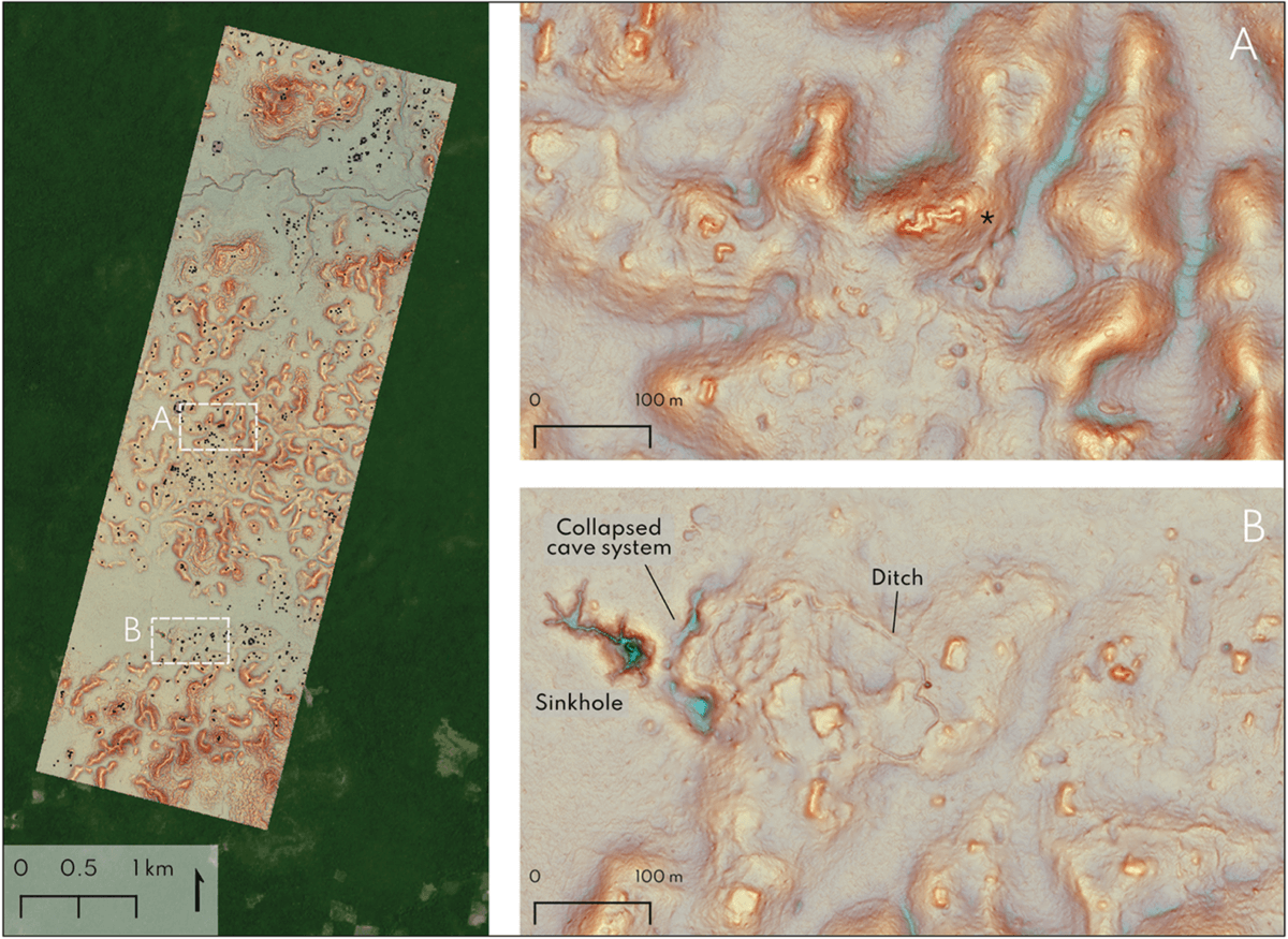
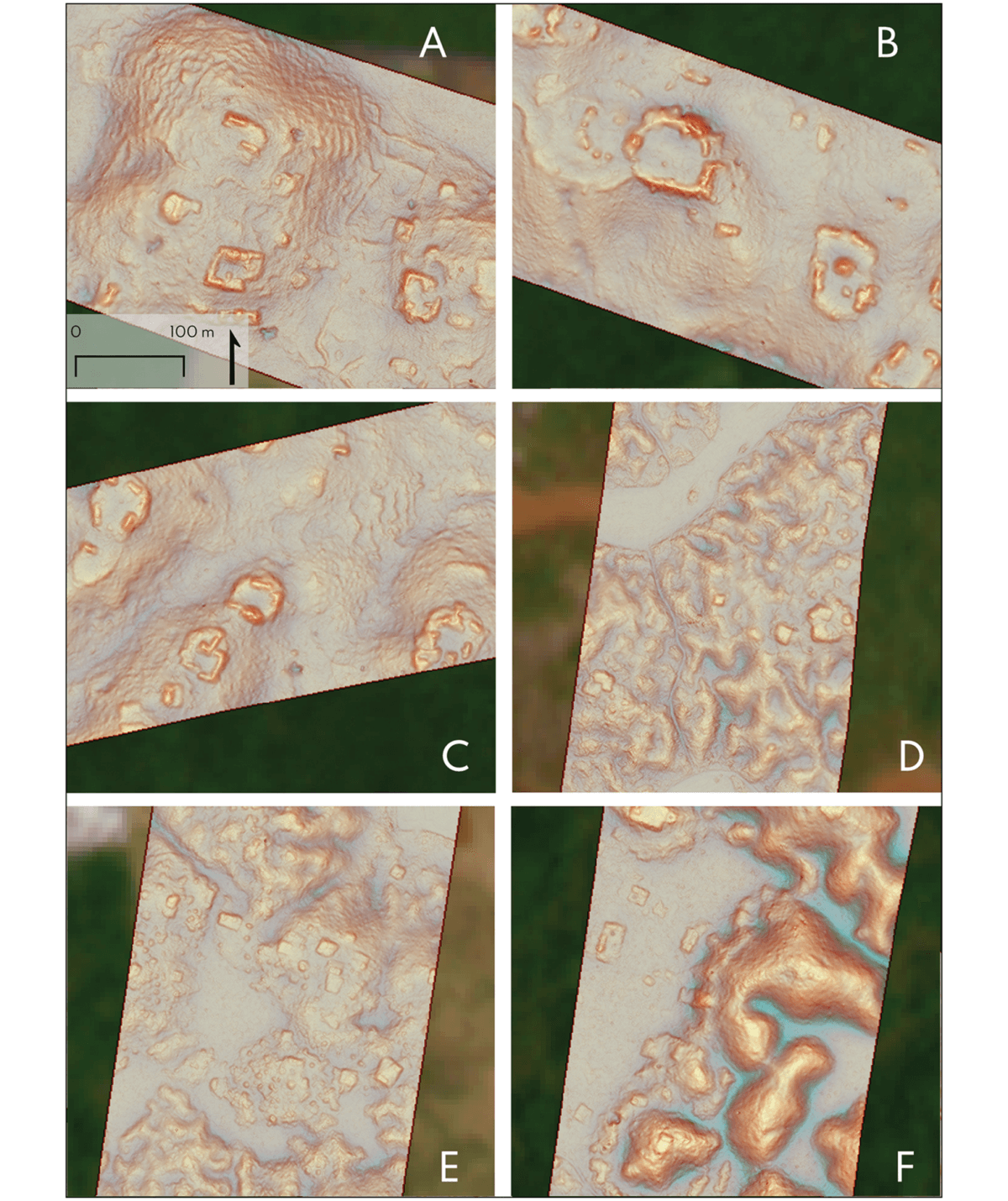
The researchers analyzed high-resolution LiDAR data collected in 2013 by a Mexican environmental monitoring project. They reprocessed the original data using specialized archaeological parameters to better reveal ancient structures. The survey covered three long, narrow strips of land (transects) about 275 meters wide and 213 kilometers long, plus three larger rectangular blocks totaling 64.1 square kilometers. Using sophisticated visualization techniques, they carefully mapped every visible ancient structure and feature, with at least three analysts independently reviewing each area to ensure accuracy.
Key Results
The team identified 6,764 ancient structures across the entire survey area, averaging 55.3 structures per square kilometer. However, density varied significantly, from nearly empty rural areas to urban zones with over 400 structures per square kilometer. They discovered one major previously unknown city (Valeriana) and documented clear regional differences in building styles and agricultural practices between the southern and northern areas.
Study Limitations
The researchers acknowledge several limitations. First, no field verification has been conducted yet, meaning some features might be misidentified. Second, small or un-mounded buildings are often invisible to LiDAR, suggesting actual structure counts were likely higher. Third, the presence of agricultural rock piles in the region might have led to some overestimation of building counts. Finally, dating the structures is impossible without excavation, making it difficult to determine which structures were contemporary with each other.
Discussion & Takeaways
The study provides strong evidence that the central Maya lowlands were more densely populated than previously thought, with urban centers being common rather than exceptional. The random nature of the survey areas strengthens this conclusion, as it eliminates potential bias from focusing on known archaeological sites. The research also helps define the boundary between southern and northern Maya cultural regions based on differences in architecture and agricultural practices.
Funding & Disclosures
The research was supported by Tulane University’s Middle American Research Institute through a grant from the Hitz Foundation. The LiDAR data was originally collected by the Alianza M-REDD+ project, led by the Nature Conservancy, Mexico, and made freely available for research purposes. The work was conducted with permission from Mexico’s National Institute of Anthropology and History.


