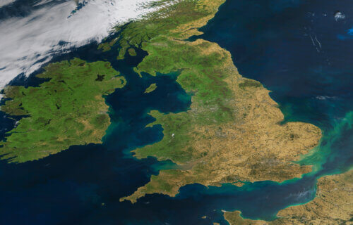
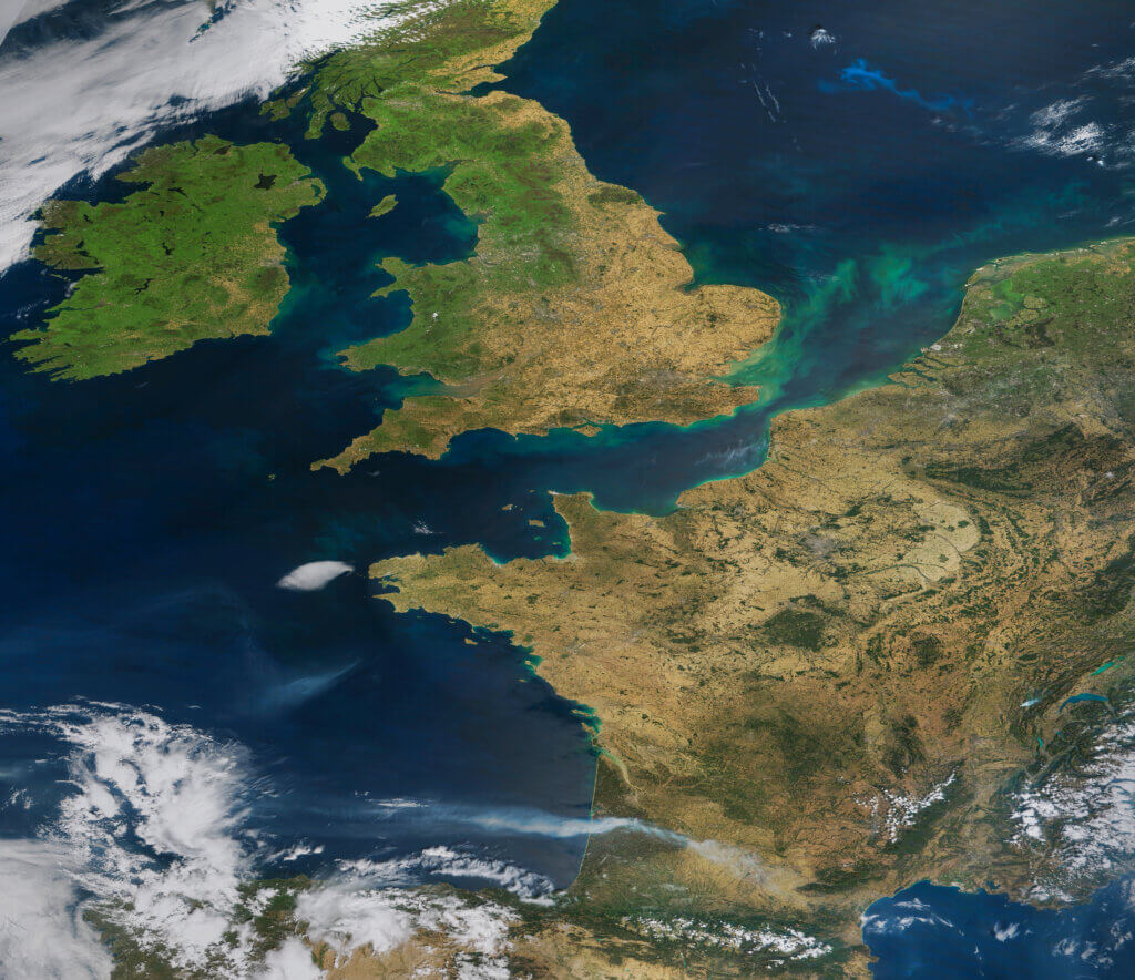
ENGLAND — This supposedly green and pleasant land is looking parched and brown. A startling satellite photograph shows Britain and Europe cloud-free on Wednesday and displaying the dulling effects of being scorched by current hot temperatures.
“This is quite a remarkable and paradigmatic image of this summer 2022; drought, wildfires and not directly visible but indirectly linked heatwave,” says satellite image “Earth Observer” Iban Ameztoy, who processed the NASA image, in a statement “This is a spectacular, but equally dramatic, MODIS/Terra image, showing cloud-free UK, Ireland, France, Netherlands and Belgium. In addition, we see turbidity patterns in the English Channel and a phytoplancton bloom in the North Sea.”
MODIS (or Moderate Resolution Imaging Spectroradiometer) is a key instrument aboard the Terra (originally known as EOS AM-1) and Aqua (originally known as EOS PM-1) satellites.
With its sweeping 2,330-km-wide viewing swath, MODIS sees every point on our world every 1-2 days in 36 discrete spectral bands.
Report by Dean Murray, South West News Service