
Last month, the United States expanded its territorial reach by 386,000 square miles, a significant increase that was announced with little fanfare. The U.S. Department of State (DOS) revealed that this expansion was due to a redefinition of the geographic coordinates that determine the outer limits of the continental shelf areas beyond 200 nautical miles from the coast. This portion, submerged under relatively shallow waters, is referred to as the “extended continental shelf” (ECS).
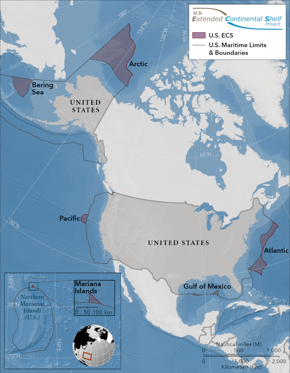
The ECS represents an offshore area that extends beyond the conventional coastal boundaries of a country. The largest segment of America’s ECS is located in the Arctic region. In total, the ECS regions, which include the Atlantic coast, the Bering Sea, the Pacific coast, the Mariana Islands, and two areas in the Gulf of Mexico, cover an area of approximately 1 million square kilometers (or 386,102.16 square miles) — twice the size of California!
The Wilson Center, a think tank based in Washington, D.C., emphasized the significance of this announcement, particularly for securing U.S. territorial rights in the Arctic. They noted that in the Arctic, the ECS extends northward up to 350 nautical miles in the east and over 680 nautical miles in the west, measured from the U.S. territorial sea baselines. “It has long been clear that the United States has major economic interests in undersea territory rich in oil, natural gas, minerals and sea life to which it has sovereign rights under the law of the sea as reflected in the Law of the Sea Convention,” the center explained in their report.
The DOS explained the concept of the continental shelf as an extension of a country’s land territory beneath the sea. Under international law, countries like the United States have the right to conserve and manage the resources and vital habitats on and beneath their ECS.
Adding to this, the Wilson Center pointed out the broader implications of this development. “The United States is a major maritime nation with the largest exclusive economic zone in the world, and this historic step helps protect its sovereign rights to vast additional subsea areas,” their reports says. “It is also an important milestone reflecting U.S. engagement with the law of the sea as reflected in the UN Convention on the Law of the Sea and as an aspect of advancing major U.S. interests in the Arctic and other regions.”
Regarding potential territorial disputes, particularly with Russia, the Center believes this will not be an issue for either country. “There is no need for a future negotiation with Russia because each country has delineated the outer limit of its continental shelf consistent with the boundary established in 1990 in the Agreement between the United States of America and the Union of Soviet Socialist Republics on the Maritime Boundary, which has been provisionally applied by agreement between the two countries,” they write.
The effort to delineate the ECS was led by the Department of State through the U.S. ECS Task Force, comprising 14 government agencies. To determine the outer limits of the ECS, data regarding the depth, shape, and geophysical characteristics of the seabed and subsoil were essential.
The National Oceanic and Atmospheric Administration (NOAA) and the U.S. Geological Survey (USGS) played pivotal roles in collecting and analyzing this data. The data collection, which began in 2003, represents the largest offshore mapping effort ever undertaken by the United States.
In its statement, the DOS highlighted the ECS’s potential, stating that the “maritime zone holds many resources (e.g., corals, crabs) and vital habitats for marine life.”
The announcement of this territorial expansion was made on December 19.
South West News Service writer Dean Murray contributed to this report.