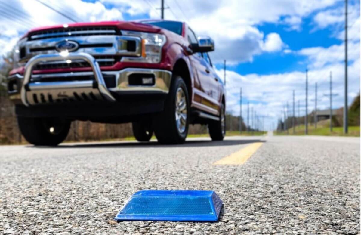
Researchers have enabled standard raised pavement markers to transmit GPS information that helps autonomous driving features function better in remote areas or in bad weather. (Credit: Carlos Jones/ORNL, U.S. Dept. of Energy)
KALAMAZOO, Mich. — Self-driving electric vehicles are advancing, but they still face challenges in terms of reliability. In an effort to overcome these obstacles, researchers are developing a solution that involves embedding high-tech markers into roadways that can communicate with autonomous EVs.
To do so, engineers are placing low-powered sensors inside reflective raised pavement markers that help drivers identify lanes. These sensors transmit information about the road shape to passing cars. This technology proves effective even when traditional vehicle cameras or remote laser sensing, such as LiDAR, face obstacles like fog, snow, or glare.
The technology is the product of a collaboration between the Department of Energy’s Oak Ridge National Laboratory (ORNL) and Western Michigan University (WMU). Their goal is to improve the accuracy and safety of autonomous driving features, particularly in remote areas.
By converting existing infrastructure into smart devices, the researchers can shift some of the processing load from the car’s software to the road infrastructure. This not only provides more accurate environmental information for the vehicle but also helps save electric vehicle battery power, extending the driving range and promoting wider adoption of electric vehicles. The chip-enabled pavement markers can reduce navigational power consumption by up to 90%, compared to a leading camera and LiDAR-based autonomous driving technologies.
This technology has the potential to enhance not only future self-driving vehicles but also existing autonomous driving features like lane assist. The WMU, leading the larger project, is collaborating with research and industry partners to develop related sensor and autonomous driving technologies, including radar retro-reflectors, high-definition mapping, computational offloading, and weather sensing. They are also measuring the reduction in vehicle energy use enabled by these technologies through closed-course vehicle testing.
ORNL researchers have extensively tested the sensor platform in various weather conditions and even in remote areas with no wireless access, such as a national park in Montana. The sensors have exceeded expectations by transmitting data more than five times the original goal of 100 meters.
“It’s amazing how far it can transmit—over hills, in snow. It’s a big deal,” says lab director Dr. Zach Asher, in a media release. “Every step of the way, we’re surprised at how well this technology is working, and we’re finding some really cool ways it could be integrated.”
Beyond providing road shape information, these sensors have the potential to signal temporary lane shifts or closures in construction zones. In the future, marker sensors could convey additional data such as temperature, humidity, and traffic volume. The research team plans to collaborate with students to develop smaller microchips for the markers as a cost-effective alternative to off-the-shelf products.
“With the hindsight of 10 years of highly-funded development, we now know that software and cameras alone don’t provide an easy solution,” says Asher. “Perhaps a more patient approach, using infrastructure-based hardware in coordination with government transportation agencies, is the way to achieve zero-accident vehicles which actually use energy sustainably.”
The paper is published in IEEE Sensors.


